Terrestrial Sedimentation and the Carbon Cycle and the Mississippi Basin Carbon ProjectRobert Stallard: Telephone: +1-303-541-3022; FAX: +1-303-447-2505 | 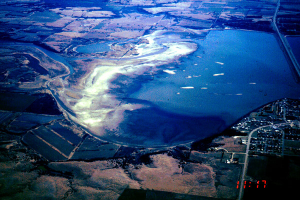 |
Terrestrial Sedimentation and the Carbon Cycle and the Mississippi Basin Carbon Project
Robert Stallard: Telephone: +1-303-541-3022; FAX: +1-303-447-2505
e-mail: stallard@colorado.edu
(1) USGS Global Processes: Terrestrial Erosion and Sedimentation and the Carbon Cycle: This activity is an examination of terrestrial sedimentation and the carbon cycle, with a focus on the Mississippi River Basin. Two hypotheses are being tested: (1) that significant amounts of carbon are buried during the deposition of sediments in terrestrial environments, and (2) that human modification of hydrologic systems enhances long-term storage of sediments and carbon. This storage is not significant unless the eroded carbon is replaced by means of photosynthetic processes. A model of global reservoir, lake, and paddyland sedimentation, has been developed and published (Stallard, 1998). We have been compiling data and developing methodologies to test these hypotheses within the Mississippi Basin Carbon Project (MBCP), an Inter-Divisional Research Project at the USGS. My component, "Carbon Transport, Nutrient Cycles, Erosion and Sedimentation in the Mississippi River Basin," emphasizes linkages among chemical erosion, physical erosion, and the carbon cycle. Data are being assembled and modeled for water, nutrient, and sediment discharge in rivers, and for carbon and sediment storage in reservoirs, lakes, wetlands, and floodplain. Methods for extracting and processing archive data from USGS water-quality data sets (NASQAN and Benchmark data) have been developed, and will be used to process data for the Mississippi River basin (nutrient loadings, carbon yields). Work is coordinated with the assembly of other geographic data sets (Mapping Division), the development of terrestrial carbon-cycle models (Water Resources Division), and field experiments (Geologic Division).
For process-level studies we are focusing on the Nishnabotna River, in southwestern Iowa and the South Platte River in Colorado. We are refining our own distributed implementation of hydrologic models (related to TOPMODEL) and an erosion model (using erosional response unites - ERU). Refinements include compilation of GIS coverages for seamless 30-m topography, 30-m contemporary land use, accurate pre-agricultural vegetation, and county-level soil data. Archived water-quality data from USGS (WQN96 CD-ROM of Alexander, et al. 1996) have been converted into a national synthesis of sediment, carbon, major dissolved constituent, and nutrient yields. This synthesis was used to estimate a riverine carbon budget for an analysis of carbon storage in the conterminous USA and was just published in Science. We continued to develop new methods for delineating basins for gage sites and reservoirs to use with both the WQN96 and the RESIS (Reservoir Sedimentation Information System) databases. Results of the MBCP were presented at a special workshop of the International Geosphere Biosphere Programme (IGBP) held in Boulder at the end of September, 2000. Within the Nishnabotna River Basin we are doing fieldwork and modeling to establish sediment budgets for colluvium, upland alluvium, and major flood plain. Here we are trying to reconstruct budgets of atmospherically derived natural (Pb-210, Be-7) and artificial radioisotopes (Cs-137) for these deposits, with consideration of re-erosion and re-sedimentation. Within the South Platte, we are focusing on the Boulder Creek watershed as a metaphor for an urbanized river system. Here, we have conducted two longitudinal studies having a comprehensive suite of high precision analyses for major constituents, trace metals, pesticides, and pharmaceuticals. In addition, we are studying several watersheds that have recently burned by fires, including the Buffalo Creek and Spring Creek catchments.
Theoretical Biogeochemistry: Processes that sculpt landscapes and generate soils are generally quite slow, yet they exert powerful controls on the chemistry of river-borne materials. We ask: (1) Can we develop general physically and biologically based models of the processes that generate the dissolved and particulate load in rivers and trace substances in the atmosphere? (2) Can we formulate geomorphically based biogeochemical models to reconstruct past terrestrial environments? This project focuses on major-element geochemistry, while using trace elements and isotopes as interpretive tools. Characterization of major-element geochemistry establishes the framework within which all other chemical data should be interpreted (This was recognized, for example, by Piper in the development of his famous diagram). My initial work focused on the tropics, because in their more stable climate, the link between chemical signatures and processes is not so obscure. There, I developed the "erosion regime" concept to look at weathering (Stallard, 1985). I am now developing the concept of "equilibrium landscapes" to predict physical erosion rates from chemical erosion (Stallard, 1995a,b). Both concepts are being tested and refined at the WEBB project sites in Puerto Rico and parallel sites in Panama and are being applied to global issues such as the carbon cycle (Stallard, 1998). Independent tests include pioneering studies using in situ-produced Be-10 (Brown et al., 1995, 1998). We are using our understanding of tropical settings to ask whether soil development and sub-glacial chemical weathering has had important effects on atmospheric carbon dioxide during deglaciations (Harden et al., 1992; Axtmann and Stallard, 1995).
Impact: Intense national interest has focused on the effects of global environmental change. Possible consequences are profound, including a rise of sea level and concomitant inundation of coastal areas and major readjustment of precipitation patterns possibly leading to serious droughts in the central U.S. Without adequate forecasting and planning, the social and economic impacts may be especially serious. This project, combining work in the Mississippi River Basin, Puerto Rico, and Panama is designed to provide detailed information about erosional and sediment dispersal phenomena and carbon sources and sinks in a representative set of temperate and humid tropical environments exhibiting a wide range of hydrological conditions and land use. This study is unique for is use of archival and modern data for the Mississippi River Basin, for its long-term, seasonal acquisition of high-precision geochemical data in humid tropical watersheds, and for its focus on the role of hydrologic, geomorphic, and pedologic processes. This research will considerably advance understanding of the surface waters, and the atmosphere. Results will contribute directly to studies of climate change induced by environmental change. Indirectly, results will contribute to greater ability to forecast climate-related trends in water resources and the effects of rising sea level on coastal aquifers and on beach erosion.
The MBCP is examining the effects of land-use change, on the carbon cycle. Particular emphasis involves study of the role of hydrological engineering, accelerated physical erosion, concomitant terrestrial sedimentation, and fertilizer applications. We are pursuing the idea that human modification of terrestrial sedimentation allows for enough sequestration of carbon in the terrestrial environment to account for the so-called "missing carbon." All of these studies are in part related to studies of global change. I first formulated the project in a letter, dated February 10, 1993, to Robert Hirsch. This idea was refined in a "flagship" proposal, dated February 23, 1993, distributed prior to the Inter-Divisional Workshop on Global Change Research and the Carbon Cycle. This "flagship" proposal underwent modest modification since it was first written. This "flagship" proposal has evolved into a global-scale model that (Stallard, 1998) that has had a profound impact in changing research directions in looking at the carbon cycle. Organizationally, this project involves Water Resources, Geologic, and Mapping Divisions. Biological Resources Division involvement is still anticipated.
This research will yield new and innovative techniques for field work and data interpretation. All components of this project merge old and ignored data sets collected by US government agencies (Pacala et al, 2001, Stallard, 2001). Critics of the USGS and other agencies have derided the failure to integrate these archives. The use of a geomorphic and biogeochemical perspective combined with new tools such as geographic information systems should make this possible. We hope that this project can serve as a model.
Recent Research Efforts (to find out more, click on effort):
- Robert Stallard Home Page.
- Luquillo USGS Water, Energy, and Biogeochemical Budget (WEBB) Project in eastern Puerto Rico and parallel work in Panama.
- Biogeochemical implications of event-type processes at the hillslope to small-watershed scale, focusing on fire-flood sequences and landslides.
- Biogeochemical implications of glacial erosion.
- The life cycle of the giant Amazon water lily.
- Intercomparison of soils, nutrients, and plants in forest-dynamics research plots of the global tropics.
- The Neotropical amphibian die-off (RANA)
.
Return to: http://spot.Colorado.EDU/~stallard/
This Home Page
University of Colorado.
US Geological Survey